

Madison County
IDGenWeb

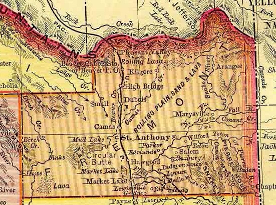
1895 Rand McNally Atlas
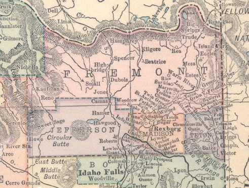
1914 Atlas
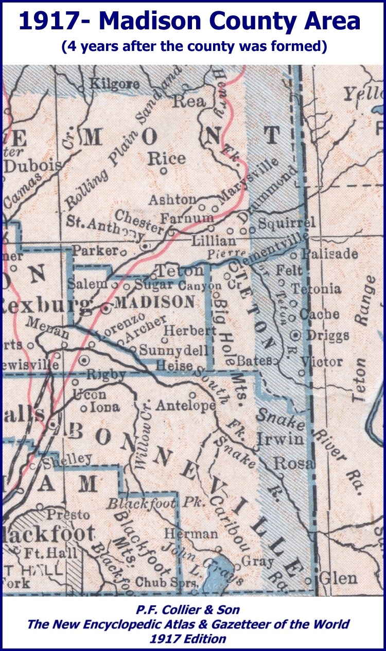
1917
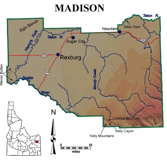
Courtesy of Digital Atlas of Idaho
2023
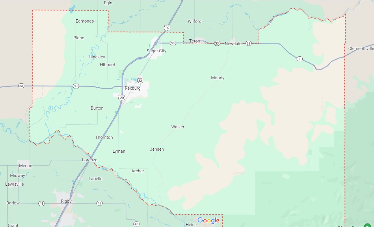
Courtesy of Google Maps
Archer 1885 GPS 434249N-1114655W
Burton GPS 434751N-1115126W
Byrne GPS 434131N-1114445W
Edmonds GPS 435447N-1115248W
Gale GPS 434555N-1114307W
Hart GPS 435303N-1114418W
Herbert (ghost town) GPS 434223N-1113933W
Hibbard GPS 435119N-1115016W
Hinckley GPS 435154N-1115127W
Independence (historical) GPS 434635N-1115458W
Jensen GPS 434434N-1114447W
Jolley GPS 435032N-1114638W
Lyman 1884 GPS 434421N-1114901W
Mark GPS 434631N-1114952W
Moody GPS 435013N-1113803W
Parkinson GPS 434858N-1113930W
Plano GPS 435328N-1115327W
Rexburg 1883 (county seat) GPS 434934N-1114720W
Salem GPS 435236N-1114620W
Sugar City GPS 435223N-1114451W
Sunnydell GPS 434104N-1114515W
Thornton 1887 (fka Texas Siding) GPS 434530N-1115040W
Walker GPS 434620N-1114228W
Woods Crossing GPS 434627N-1113747W
Argument Ridge (Ridge) GPS 433940N-1112725W Altitude 7703
Beartrap Canyon (Valley) GPS 433754N-1112451W Altitude 6083
Big Island (Island) GPS 435140N-1115245W Altitude 4823
Bitters Butte (Summit) GPS 435011N-1113519W Altitude 5489
Buckskin Morgan Ridge (Ridge) GPS 433852N-1113625W Altitude 6647
Canyon Creek Butte (Summit) GPS 434941N-1113029W Altitude 6129
Carlton Cutoff Trail (Trail) GPS 434228N-1112559W Altitude 7093
Coalmine Canyon (Valley) GPS 433823N-1112628W Altitude 6027
Dry Canyon (Valley) GPS 434727N-1113657W Altitude 5210
East Farnes Mountain (Summit) GPS 434036N-1112832W Altitude 7267
Farnes Mountain (Summit) GPS 434007N-1112956W Altitude 7375
Flat Hollow (Valley) GPS 434459N-1112700W Altitude 6135
Graham Hollow (Valley) GPS 434140N-1113324W Altitude 5830
Hawley Gulch (Valley) GPS 433746N-1113526W Altitude 5748
Henrys Lake Mountains (Range) GPS 444652N-1112400W Altitude 10148
Kirkham Hollow (Valley) GPS 434348N-1112732W Altitude 6283
Limekiln Canyon (Valley) GPS 433942N-1113154W Altitude 6289
Little Burns Canyon (Valley) GPS 433737N-1112540W Altitude 5646
Little Island (Island) GPS 435101N-1115323W Altitude 4819
Long Hollow (Valley) GPS 434851N-1113701W Altitude 5144
Lookout Mountain (Summit) GPS 433809N-1113404W Altitude 6713
Menan Buttes (Summit) GPS 434704N-1115823W Altitude 5230
Millward Slough (Gut) GPS 435143N-1115332W Altitude 4823
Moody Meadow (Flat) GPS 434054N-1112745W Altitude 6762
Moody Swamp (Swamp) GPS 434005N-1112703W Altitude 7155
Poison Flat (Flat) GPS 433750N-1113522W Altitude 5738
Pole Canyon (Valley) GPS 434159N-1113131W Altitude 6037
Prospect Peak (Summit) GPS 433920N-1112232W Altitude 8028
Raynolds Pass (Gap) GPS 444240N-1112811W Altitude 6831
Red Butte (Summit) GPS 433938N-1112025W Altitude 8333
Sawmill Gulch (Valley) GPS 434157N-1113136W Altitude 6020
Sommers Butte (Summit) GPS 434808N-1114232W Altitude 5351
Spooky Canyon (Valley) GPS 433938N-1113152W Altitude 6296
Spori Canyon (Valley) GPS 433910N-1113121W Altitude 6398
Twin Peaks (Summit) GPS 433759N-1112836W Altitude 7710
Webster Butte (Summit) GPS 434729N-1114203W Altitude 5335
West Farnes Mountain (Summit) GPS 434009N-1112955W Altitude 7362
White Owl Butte (Summit) GPS 434552N-1113339W Altitude 6322
Windy Ridge (Ridge) GPS 433919N-1113251W Altitude 6640
Bannock Jim Slough (Stream) GPS 434554N-1115646W Altitude 4810
Browning Creek (Stream) GPS 434222N-1113113W Altitude 6060
Buck Spring (Spring) GPS 433925N-1112144W Altitude 7592
Buck Spring (Spring) GPS 434020N-1113449W Altitude 6217
Buckhorn Spring (Spring) GPS 433812N-1113615W Altitude 6132
Calamity Creek (Stream) GPS 434652N-1112650W Altitude 5860
Canyon Creek Canal (Canal) GPS 435208N-1113023W Altitude 5522
Canyon Creek (Stream) GPS 435501N-1112746W Altitude 5089
Carlton Creek (Stream) GPS 434611N-1112645W Altitude 5958
Cartier Slough (Stream) GPS 434758N-1115624W Altitude 4813
City of Rexburg Ditch (Canal) GPS 434850N-1114737W Altitude 4865
Clarke Creek (Stream) GPS 434152N-1113141W Altitude 5997
Clements Spori Ditch (Canal) GPS 435116N-1115030W Altitude 4852
Coalmine Creek (Stream) GPS 433824N-1112629W Altitude 6083
Cold Spring (Spring) GPS 433857N-1113341W Altitude 6316
Conner Spring (Spring) GPS 433827N-1113226W Altitude 5994
Consolidated Farmers Canal (Canal) GPS 435454N-1114522W Altitude 4882
Crooked Creek (Stream) GPS 435239N-1112635W Altitude 5331
East Farnes Mountain Spring (Spring) GPS 434043N-1112851W Altitude 7211
East Fork Hilton Creek (Stream) GPS 434124N-1113032W Altitude 6480
East Teton Canal (Canal) GPS 435242N-1113835W Altitude 4993
Elkhorn Warm Spring (Spring) GPS 433936N-1114258W Altitude 5164
Fish Creek (Stream) GPS 434135N-1113312W Altitude 5873
Garner Creek (Stream) GPS 434152N-1113149W Altitude 5991
Gilbert Ditch (Canal) GPS 434440N-1114735W Altitude 4892
Hawley Spring (Spring) GPS 433927N-1113412W Altitude 6276
Hawley Warm Spring (Spring) GPS 433913N-1114206W Altitude 5308
Henrys Fork (Stream) GPS 434510N-1115728W Altitude 4800
Hilton Creek (Stream) GPS 434139N-1112958W Altitude 6558
Hinckley Creek (Stream) GPS 433912N-1113023W Altitude 6532
Island Ward Canal (Canal) GPS 435143N-1114903W Altitude 4859
Jensen Creek (Stream) GPS 433729N-1112557W Altitude 5584
Kelly Spring (Spring) GPS 433835N-1113713W Altitude 5981
Leatham Dam (Dam) GPS 434230N-1113939W Altitude 5587
Lenroot Canal (Canal) GPS 434347N-1114743W Altitude 4905
Liberty Park Canal (Canal) GPS 434638N-1115330W Altitude 4829
Lost Spring (Spring) GPS 434400N-1112447W Altitude 7087
Lyons Creek (Stream) GPS 434101N-1114441W Altitude 4977
Marlow Creek (Stream) GPS 433957N-1112909W Altitude 6749
Moody Creek (Stream) GPS 435131N-1114155W Altitude 4918
Moody Swamp (Swamp) GPS 434005N-1112703W Altitude 7155
Mud Springs (Spring) GPS 434317N-1113135W Altitude 6220
North Moody Creek (Stream) GPS 434145N-1113311W Altitude 5853
Pincock Garner Ditch (Canal) GPS 435335N-1114156W Altitude 4924
Pincock Hot Springs (Spring) GPS 434729N-1112611W Altitude 5938
Pony Creek (Stream) GPS 435000N-1112617W Altitude 5718
Quayles Lake (Lake) GPS 435547N-1115411W Altitude 4852
Reid Canal (Canal) GPS 434525N-1114846W Altitude 4875
Rexburg Canal (Canal) GPS 434909N-1114938W Altitude 4849
Ruby Creek (Stream) GPS 434046N-1112748W Altitude 6713
Saint Anthony and Independent Canal (Canal) GPS 435112N-1115357W Altitude 4836
Salem Canal (Canal) GPS 435235N-1114524W Altitude 4895
Sheep Creek (Stream) GPS 434255N-1113000W Altitude 6204
South Branch Rexburg Canal (Canal) GPS 434731N-1114819W Altitude 4849
South Moody Creek (Stream) GPS 434145N-1113311W Altitude 5853
South Teton River (Stream) GPS 435041N-1115304W Altitude 4819
Spring Creek (Stream) GPS 434653N-1112651W Altitude 5876
Spring Slough (Stream) GPS 434606N-1115450W Altitude 4823
State Creek (Stream) GPS 434109N-1113322W Altitude 5978
Sunnydell Canal (Canal) GPS 434205N-1114518W Altitude 4961
Teton Canal (Canal) GPS 435257N-1114004W Altitude 4954
Teton Dam (Dam) (collapsed in 1976) GPS 435435N-1113221W Altitude 5033
Teton Island Canal (Canal) GPS 435144N-1114444W Altitude 4895
Teton River (Stream) GPS 435356N-1115021W Altitude 4829
Texas Slough Canal (Canal) GPS 434759N-1115111W Altitude 4836
Texas Slough (Stream) GPS 434749N-1115530W Altitude 4813
Warm Slough (Stream) GPS 435216N-1115208W Altitude 4823
Westfield Branch Canal (Canal) GPS 434942N-1114813W Altitude 4859
Woodmansee Johnson Canal (Canal) GPS 435044N-1114227W Altitude 4915
Woods Creek (Stream) GPS 433558N-1112850W Altitude 5171
Wright Creek (Stream) GPS 434839N-1112622W Altitude 5771
Adams Elementary School GPS 434944N-1114640W
Archer Elementary School GPS 434258N-1114700W
Burton Elementary School GPS 434803N-1115127W
Central Elementary School GPS 435228N-1114437W
Hibbard Elementary School GPS 435039N-1115019W
Kennedy Elementary School GPS 434929N-1114754W
Kershaw Intermediate School GPS 435234N-1114423W
Madison High School GPS 434945N-1114610W
Madison Junior High School GPS 434936N-1114703W
Moody School GPS 435118N-1114119W
Ricks College GPS 434916N-1114657W
Ricks College was founded in 1888 as the Bannock State Academy. The name was changed to Ricks in 1903.
The name has since been changed to Brigham Young University-Idaho.
Sugar - Salem High School GPS 435222N-1114423W
Sugar-Salem Junior High School GPS 435225N-1114458W
Union-Lyman Elementary School GPS 434420N-1114903W
Washington Elementary School GPS 434936N-1114714W
Apostolic Church, 1866 N Hwy 33, Sugar City, ID; 208-359-2050
Church of Jesus Christ of Latter-day Saints, visit the nearest Family History Center
for information about early Ward records, deceased member's records, and early church history.
Individual Wards do not have those records.
Community Presbyterian Church, 104 College Ave, Rexburg, ID 83440; 208-356-9313
Foursquare Gospel; Rexburg Christian Center, 241 S 5th W, Rexburg, ID 83440; 208-356-4284
Grace Baptist Church, 262 N 2nd W, Rexburg, ID 83440; 208-356-7621
Lighthouse Bible Baptist Church, 1816 N Hwy 33, Sugar City, ID; 208-356-7427
Mormon, see Church of Jesus Christ of Latter-day Saints
St. Patrick's Station Catholic Church, Rexburg, ID 83440
Trinity Baptist Church, 31 N 2000 W, Rexburg, ID 83440; 208-356-0864
Upper Valley Assembly of God, P.O. Box 831, Rexburg, ID 83440; 208-356-0122
Beaver Dick Cemetery GPS 435017N-1115320W
Burton Cemetery GPS 434723N-1114948W
Plano Cemetery GPS 435323N-1115404W
Rexburg Cemetery GPS 435056N-1114741W
Sugar City Cemetery GPS 435031N-1114414W
Sutton Cemetery GPS 434327N-1114537W
Teton Cemetery GPS 435212N-1113953W
Source for listed features: USGS GNIS
Copyright © 1996- The USGenWeb® Project, IDGenWeb, Madison County

This page was last updated
05/29/2026